Bright sunshine and chilly temperatures this mid-day Wednesday here in California’s Central Valley — the summer solstice today, the opening round of summer. The clock spun from spring to summer reportedly at 7:58 this morning PDT, and we’re now well into the cycle.
Except summer is nowhere to be seen/felt here in California.
Unlike a goodly chunk of the rest of the planet, especially parts of the US, we here on the Left Coast are cooling it again:
Daytime temperatures throughout our area will remain several degrees below climatological normals on Wednesday and Thursday. #cawx pic.twitter.com/5SOXONuC1h
— NWS Hanford (@NWSHanford) June 21, 2023
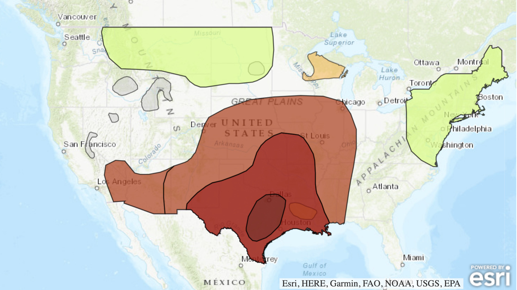
Despite the seasonal shift, an abnormally cold Pacific Ocean coupled with high pressure in the Pacific Northwest keeps us chilled out as the heat persists elsewhere:
 (Image: Excessive heat map of the US, and found here.)
Summer runs — via NPR this morning:
“Excessive” is the word of the day in the National Weather Service’s forecast for the summer solstice — the term appears seven times, describing record heat and torrential rainfall that different areas of the U.S. are experiencing.
Forecasters said extreme weather would hit many parts of the country on the longest day of the year, as the 2023 summer solstice occurred at 10:58 a.m. ET, according to the U.S. Naval Observatory.
“The never-ending excessive heat across Texas and parts of the Southern U.S. will persist the rest of week with dangerous conditions,” the NWS said.
People are trying to cope with extreme weather against the backdrop of two longer-term patterns that could combine to make this summer a tough one to endure. Climate change is making once-unthinkable heat waves more likely; and an El Niño pattern of warmer sea temperatures is now in effect, threatening to amplify summer weather extremes even further.
[…]
Other areas in the lower 48 states are seeing different extremes, with freeze warnings and even potential snow forecast in northeastern Nevada and southern Oregon, where people were warned of potential damage to sensitive plants and crops.
“Snow in June!?” the NWS office in Medford said on Sunday.
The region is expected to start seeing more normal temperatures on the solstice, but earlier this week, the Oregon towns of Montague and Medford both set new minimum-high records, of 59 and 56 degrees.
Whiplash weather, so they say.
And does one wonder about elsewhere without California’s cool ambiance:
Summer heat, or not, yet once again here we are…
 (Illustration out front: Salvador Dali’s ‘Soft Watch at the Moment of First Explosion,’ found here.)